
Observatoire de Haute-Provence: A Station Profile
High on a limestone plateau in the Alpes-de-Haute-Provence, far from the glow of major cities, sits one of the quiet workhorses of European atmospheric science. The Observatoire de Haute-Provence (OHP) is often associated with its historic telescopes and the discovery of the first exoplanet around a Sun-like star, but for our community its real value lies elsewhere: in decades of patient, precise lidar measurements of the stratosphere. In this station profile, we look at why OHP matters to NDACC, how its lidar systems work, and what its long-term records tell us about ozone recovery and climate.
Why Observatoire de Haute-Provence Matters to NDACC
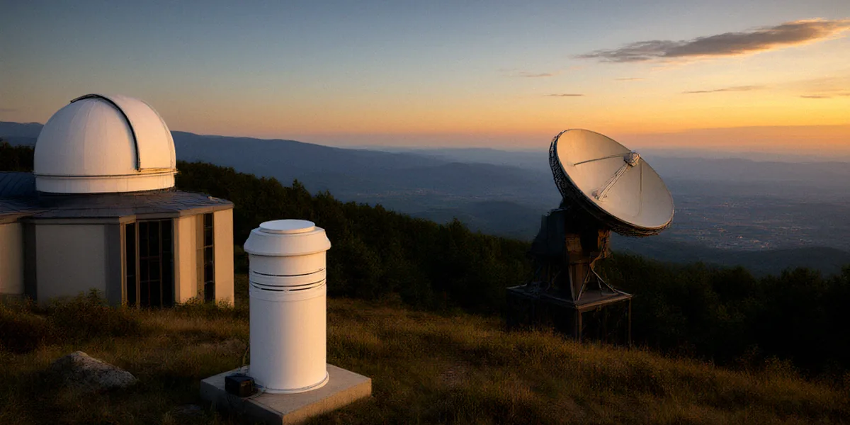
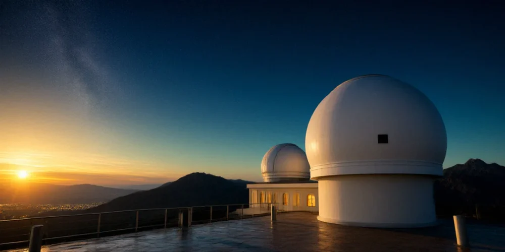
The Observatoire de Haute-Provence is a CNRS facility in Saint-Michel-l’Observatoire, France, roughly 90 kilometres north-east of Marseille. Its combination of clean air, high altitude and stable weather has made it a natural home for remote sensing, and since the early 1990s it has operated as a long-standing NDACC site in southern France. OHP hosts NDACC lidar instruments for ozone and temperature profiling, and those instruments have been contributing to the network’s global database for decades.
A Strategic Location for Atmospheric Science
Location matters in atmospheric science. OHP sits at around 650 metres above sea level, well away from industrial pollution plumes, which keeps background aerosol levels low and makes the free troposphere and stratosphere easier to isolate in the signal. Its position in the mid-latitudes of Western Europe also fills a geographical gap: between the polar stations of the far north and the subtropical and tropical sites further south, OHP provides a crucial reference point for understanding how stratospheric circulation and ozone behave across European latitudes.
OHP’s Role Within the NDACC Network
Within NDACC, OHP is one of the stations that ties together several measurement techniques. Its lidars sit alongside other instruments at the site, and the resulting data feed directly into the network’s shared archives. That means a researcher in Cambridge, Leeds or Tokyo can download OHP ozone and temperature profiles and compare them with measurements from Mauna Loa, Lauder or Ny-Ålesund, using the same formats and quality standards. This standardisation is what transforms a single mountain-top observatory into part of a genuinely global atmospheric science network.
The Lidar Systems at OHP: Instruments and Capabilities
Lidar — light detection and ranging — works by firing short pulses of laser light into the atmosphere and timing the faint return signal that scatters back from molecules, aerosols and, in some configurations, specific trace gases. At OHP, this principle is applied to two main targets: ozone and temperature. The techniques used are Rayleigh and DIAL, and together they allow the station to profile the stratosphere from roughly the lower troposphere up into the upper stratosphere.
Ozone DIAL and Rayleigh Lidar Systems
The ozone lidar at OHP uses the Differential Absorption Lidar (DIAL) technique. Two laser wavelengths are emitted: one that is strongly absorbed by ozone and one that is only weakly absorbed. By comparing the returned signals at both wavelengths, the system can calculate ozone concentration as a function of altitude. This gives a vertical profile of stratospheric ozone that is independent of satellite retrievals and can be used to validate them. The same instrument suite also exploits Rayleigh scattering — elastic backscatter from air molecules — to derive atmospheric density and temperature in the upper stratosphere, where the signal is dominated by molecular scattering rather than particles.
Temperature and Aerosol Measurements
Temperature profiling at OHP relies on the fact that the intensity of Rayleigh backscatter depends on atmospheric density, which in turn is linked to temperature through hydrostatic balance. By measuring the return signal profile and applying careful corrections, the team derives temperature profiles extending well into the stratosphere. Alongside this, the lidars can detect aerosol layers — including volcanic sulphate aerosols and, occasionally, smoke or dust transported from distant sources. These aerosol measurements are valuable for understanding how particles influence stratospheric chemistry and radiative balance.
From Photons to Profiles: How OHP Lidar Data Are Used
A raw lidar return is just a noisy curve of photon counts against time. Turning that into a scientifically usable atmospheric profile takes a well-defined chain of processing steps, and OHP follows NDACC data protocols throughout.
Data Processing and Quality Assurance
The workflow typically involves:
- Background subtraction and range correction of the raw photon-counting signal;
- Dead-time correction and overlap corrections for the near-field region;
- Application of DIAL or Rayleigh retrieval algorithms to derive ozone or temperature;
- Calibration against reference instruments and standard atmospheres;
- Uncertainty estimation, screening for clouds, and flagging of contaminated profiles;
- Submission to the NDACC data archive in a standardised format.
Regular intercomparisons with ozonesondes, satellites and other NDACC lidars help keep the OHP record consistent. This quality assurance is not glamorous, but it is what allows the data to be used with confidence in long-term trend studies.
Contributions to Ozone and Climate Assessments
OHP lidar data contribute to WMO ozone assessments, which are the authoritative international reports on the state of the ozone layer. Because the station’s record stretches back over multiple decades, it helps answer one of the most important questions in atmospheric science: is the stratospheric ozone layer recovering following the Montreal Protocol? Ground-based lidar profiles like those from OHP provide the long-term, well-characterised measurements needed to separate real trends from natural variability.
Long-Term Records and Scientific Highlights
Continuity is the hardest thing to achieve in observational science, and it is where OHP excels. The station’s multi-decadal lidar records are among the longer ground-based stratospheric datasets in Europe.
Ozone Trend Analysis from OHP
Analyses using OHP ozone profiles have documented the decline in stratospheric ozone during the 1980s and 1990s, and more recently the signs of stabilisation and partial recovery in the upper stratosphere. These findings align with the broader picture assembled from NDACC stations worldwide, and they carry real policy weight because they underpin the periodic WMO assessments.
Stratospheric Temperature and Aerosol Events
OHP’s temperature lidar has captured the stratospheric warming that follows major volcanic eruptions, including the signal from Mount Pinatubo in 1991, and the subsequent cooling as sulphate aerosols settled out. The station has also recorded temperature anomalies linked to sudden stratospheric warmings, which influence weather patterns over Europe. These events matter to UK researchers because stratospheric variability can feed down into tropospheric circulation and affect seasonal forecasting.
Challenges and the Future of Lidar at OHP
Running a lidar station for decades is not easy. Instruments age, lasers need replacing, and clear-sky nights are never guaranteed.
Operational and Environmental Challenges
The main pressures we see at OHP are familiar across the NDACC network: ageing laser systems and optics that require specialist maintenance; the need for stable, long-term funding to retain skilled staff; and weather, since lidar profiling requires clear or partially clear skies. Wildfire smoke and Saharan dust episodes can also contaminate profiles, requiring careful screening.
Planned Upgrades and Network Integration
Future plans at OHP focus on modernising laser and detection systems to improve reliability and extend profiling range, while maintaining continuity with the existing record. Continued integration with NDACC means data will keep flowing into international archives and remain comparable with other stations. For a network built on consistency, that continuity is the priority.
What OHP Means for the UK Atmospheric Science Community
OHP is not just a French asset. It is part of the shared infrastructure that UK atmospheric scientists rely on.
UK Collaborations and Data Sharing
University of Cambridge and University of Leeds researchers use OHP data in their studies of stratospheric ozone and temperature, often combining it with satellite observations and model simulations. The Met Office collaborates on NDACC-related atmospheric studies, drawing on ground-based lidar records to evaluate and constrain its own models. Joint field campaigns and shared calibration exercises have strengthened these links over the years.
Lessons for UK Lidar Stations
For UK-based lidar groups, OHP offers a useful model: long-term commitment to a single site, rigorous data protocols, and active participation in international networks. The station shows that sustained, careful measurement — rather than short bursts of activity — is what produces data of lasting scientific value.
FAQ
What is the Observatoire de Haute-Provence?
It is a CNRS research facility in Saint-Michel-l’Observatoire, France, known for astronomy but also home to long-term atmospheric lidar instruments measuring ozone and temperature.
What lidar techniques does OHP use?
OHP uses DIAL for ozone profiling and Rayleigh lidar techniques for temperature and aerosol measurements in the stratosphere.
How does OHP data help ozone monitoring?
Its multi-decadal ozone profiles contribute to WMO ozone assessments and help track the recovery of the stratospheric ozone layer.
Do UK researchers use OHP data?
Yes. Researchers at the University of Cambridge and University of Leeds use OHP data, and the Met Office collaborates on NDACC-related atmospheric studies.
Why is OHP important to NDACC?
It is a long-standing NDACC site that provides well-calibrated, continuous ozone and temperature profiles from a key mid-latitude location in Western Europe.
OHP’s sustained lidar measurements are essential for understanding stratospheric ozone recovery, and its data remain a cornerstone for NDACC and UK researchers alike. As long as the lasers keep firing on clear Provençal nights, the station will keep adding to one of Europe’s most valuable atmospheric records.