Temperature Profiling with Rayleigh Lidar: How We Measure the Stratosphere
Why would anyone care about the temperature of the air 30 to 80 kilometres above the UK? That region — the stratosphere and lower mesosphere — is where the ozone layer sits, where volcanic aerosols linger for years, and where the first signs of climate-driven circulation change are appearing. Satellites pass over it, but they need ground truth. Radiosondes float through it, but they burst long before reaching it. This is where Rayleigh lidar comes in. Our team operates and analyses these instruments as part of NDACC (the Network for the Detection of Atmospheric Composition Change), which coordinates global lidar measurements so that researchers can compare temperature profiles from the Arctic to the Antarctic. In this post, we explain how a Rayleigh lidar actually works, how we turn scattered photons into a temperature profile, and why sustained UK participation in this network matters.
Why Temperature Profiling Matters in Atmospheric Science
Temperature is not just a number on a weather chart. In the stratosphere, it controls the rate of ozone chemistry, the formation of polar stratospheric clouds, and the strength of the winter polar vortex. A few degrees of warming or cooling in the middle atmosphere can shift the altitude at which ozone is destroyed and the speed at which the Brewer-Dobson circulation transports ozone from the tropics to the poles. Long-term temperature records from lidar instruments are therefore essential for climate monitoring — they help us separate real trends from the noise of seasonal and solar variability, and they provide independent validation for satellite instruments such as Aura MLS.
The Link Between Temperature and Ozone Depletion
Ozone chemistry is highly temperature-dependent. Heterogeneous reactions on polar stratospheric clouds — the reactions that convert chlorine reservoirs into ozone-destroying forms — occur only below roughly 195 K. Warmer stratospheric temperatures mean fewer clouds and slower ozone depletion; colder temperatures mean more. By measuring temperature profiles at high vertical resolution, Rayleigh lidar helps us understand these thresholds and track how the ozone layer is responding to changing stratospheric conditions. This is directly relevant to ozone monitoring across the NDACC network, where lidar temperature data feed into analyses of ozone recovery.
NDACC’s Global Temperature Monitoring Network
NDACC is a worldwide network of instruments that measure atmospheric composition and temperature. Its lidar working group coordinates Rayleigh and Raman lidar measurements, sets standards for data processing, and maintains a shared archive so that researchers can compare profiles from different stations. The network includes sites in Europe, North America, Asia, and the tropics. The UK contributes through the Chilbolton Observatory in Hampshire, which hosts a Rayleigh lidar used for temperature profiling, and through research activity at the Rutherford Appleton Laboratory in Oxfordshire. Together, these stations provide a long-term record of stratospheric temperature that no single instrument could deliver alone.
How Rayleigh Lidar Works: Principles and Instrumentation
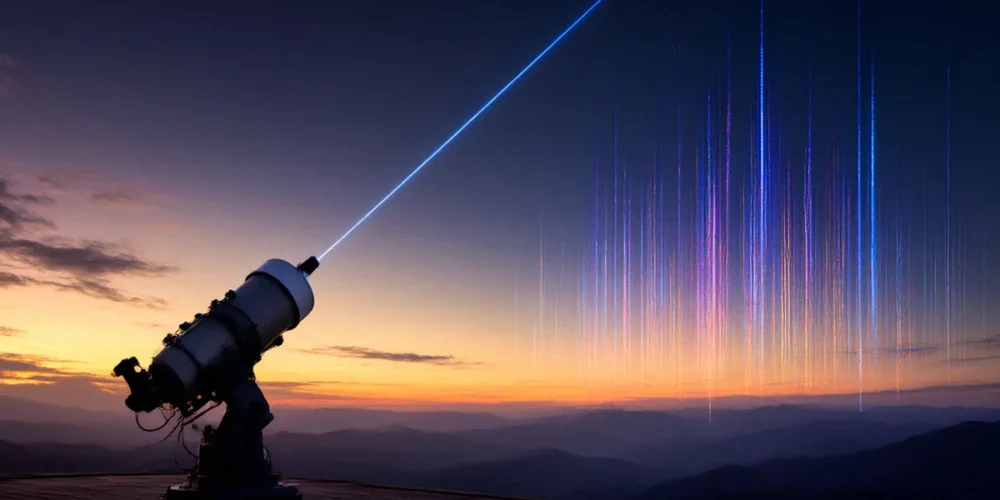
Rayleigh lidar is a simple idea executed with precision. A laser fires short pulses of light upward into the atmosphere. As the light travels through the air, it scatters off molecules — mostly nitrogen and oxygen — in a process called Rayleigh scattering. A telescope on the ground collects the backscattered light, and a detector measures how much returns at each time delay. Because light travels at a known speed, each time delay corresponds to a specific altitude. The intensity of the return signal at each altitude tells us how dense the atmosphere is there, and from that we can derive temperature. NDACC Rayleigh lidars typically operate at wavelengths around 532 nm, where the scattering is strong and the laser is reliable.
Rayleigh Scattering vs. Mie Scattering
Rayleigh scattering is the elastic scattering of light by molecules much smaller than the wavelength of the light. It is the reason the sky is blue. In the lidar context, Rayleigh scattering provides a clean, well-understood signal that depends on atmospheric density and molecular properties. Mie scattering, by contrast, is scattering by larger particles — aerosols, dust, and cloud droplets. Mie scattering is strongly forward-peaked and much more intense than Rayleigh scattering, which can contaminate the signal in the lower atmosphere. In the middle atmosphere, above 30 km, aerosols are sparse, so the Rayleigh signal dominates. This is one reason Rayleigh lidars are particularly effective for temperature profiling from about 30 km to 80 km altitude.
Key Components of a Rayleigh Lidar System
Every Rayleigh lidar system has the same core components, though the details vary by station:
- Laser: A pulsed laser, often a frequency-doubled Nd:YAG or similar system, emits short pulses at 532 nm. The laser must be stable, reliable, and eye-safe.
- Beam steering: Mirrors direct the laser beam into the atmosphere, typically at a small angle from vertical to avoid specular reflections.
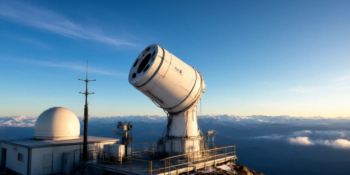
- Telescope: A large telescope collects the backscattered light. The size of the telescope determines the signal strength and the altitude range.
- Detector: A photomultiplier tube or CCD detector measures the collected photons. The detector must be sensitive enough to count single photons and fast enough to resolve altitude bins.
- Data acquisition: Electronics record the photon counts as a function of time, and software converts the time series into a raw lidar profile.
From Photons to Profiles: Data Retrieval and Challenges
Raw photon counts are not temperature. To get a temperature profile, we process the raw signal in several steps. First, we average many laser pulses to reduce noise. Second, we subtract the background signal — the light from the sky and from the detector itself. Third, we correct for the range-squared falloff in the signal and for the transmission of the atmosphere. Finally, we invert the density profile to temperature using the ideal gas law and hydrostatic equilibrium. This inversion requires a seed temperature at a high altitude, typically taken from satellite data or a model, because the lidar signal alone cannot determine the absolute temperature at the top of the profile.
The Temperature Inversion Algorithm
The temperature inversion algorithm works from the top of the profile downward. At the seed altitude, we assume a temperature from a satellite or model. Then we integrate the hydrostatic equation downward, using the density profile derived from the lidar signal to compute the temperature at each lower altitude. The algorithm is well-established, but it is sensitive to the seed temperature and to the quality of the density profile. Small errors at the top can propagate downward, so careful processing is essential.
Sources of Error and Uncertainty
Rayleigh lidar temperature profiles are subject to several sources of error. The most important are:
- Seed temperature uncertainty: The choice of seed temperature at the top of the profile affects the entire profile.
- Signal noise: Photon counting statistics introduce noise that increases with altitude.
- Background subtraction: Errors in estimating the background signal can bias the profile.
- Aerosol contamination: In the lower stratosphere, aerosols can contaminate the Rayleigh signal.
- Instrument stability: Long-term drifts in the laser or detector can affect the temperature record.
We quantify these uncertainties and report them alongside the temperature profiles, so that users can assess the reliability of the data.
Rayleigh Lidar in the NDACC Network: UK Contributions
The UK has a long history of lidar research and contributes to NDACC through several stations and research programmes. The Chilbolton Observatory in Hampshire hosts a Rayleigh lidar used for temperature profiling, and the Rutherford Appleton Laboratory in Oxfordshire contributes to lidar research and NDACC. These UK stations provide long-term temperature records that are used in climate monitoring and satellite validation. UK researchers also collaborate with European partners through projects like ACTRIS, which coordinates atmospheric research infrastructure across Europe.
Chilbolton Observatory: A Key UK Site
The Chilbolton Observatory is a major UK facility for atmospheric research. Its Rayleigh lidar has been used for temperature profiling for many years, and its data are part of the NDACC archive. The site’s location in southern England makes it well-placed to observe the mid-latitude stratosphere, and its long-term record is valuable for detecting trends and for validating satellite instruments.
Collaboration with European Partners
UK lidar research does not happen in isolation. Through projects like ACTRIS, UK researchers collaborate with European partners to standardise instruments, share data, and improve retrieval algorithms. This collaboration is essential for maintaining the quality of the NDACC record and for ensuring that UK data are comparable with data from other stations.
Comparing Rayleigh Lidar with Other Temperature Measurement Techniques
Rayleigh lidar is one of several techniques for measuring atmospheric temperature. Each technique has its strengths and limitations. Satellites, such as Aura MLS, provide global coverage but have coarse vertical resolution and require validation. Radiosondes provide high-resolution profiles but only in the lower atmosphere and only at specific times. Rotational Raman lidar provides temperature profiles with high vertical resolution but is more complex and more expensive than Rayleigh lidar. Rayleigh lidar’s strength is its high vertical resolution and its ability to operate in the middle atmosphere, where other techniques are less effective.
Advantages Over Satellite and In Situ Methods
Rayleigh lidar offers several advantages over satellite and in situ methods. It provides high vertical resolution, which is essential for resolving fine-scale structures in the stratosphere. It can operate continuously, providing profiles at night and, with some systems, during the day. It is also independent of satellites, which means it can be used to validate satellite data and to fill gaps in satellite coverage.
Limitations and Complementary Approaches
Rayleigh lidar is not a complete solution. It requires clear skies, so it cannot operate through thick clouds. It is also limited to nighttime operation for most systems, because daylight background light overwhelms the weak Rayleigh signal. And it requires a seed temperature, which introduces a dependency on other data sources. For these reasons, Rayleigh lidar is best used in combination with other techniques — satellites, radiosondes, and Raman lidar — to provide a complete picture of atmospheric temperature.
Future Directions and Our Team’s Perspective
Rayleigh lidar technology is evolving. New systems are being designed to be more autonomous, more reliable, and more capable of operating in remote locations. Data assimilation techniques are improving, allowing lidar data to be integrated more effectively into weather and climate models. And the importance of long-term monitoring is becoming clearer, as the climate continues to change. Our team believes that sustaining NDACC observations is essential for understanding stratospheric change, and we are committed to maintaining UK participation in the network.
Technological Innovations in Rayleigh Lidar
Several technological developments are shaping the future of Rayleigh lidar. Autonomous systems can operate without constant human intervention, reducing costs and enabling measurements at remote sites. Improved lasers and detectors are increasing the signal-to-noise ratio, allowing profiles to be measured at higher altitudes and with greater precision. And advances in data processing are making it easier to compare lidar data with other datasets.
The Case for Long-Term Monitoring
Long-term monitoring is essential for detecting trends in stratospheric temperature. A single profile tells us about the atmosphere at one moment; a multi-decade record tells us about climate change. NDACC’s long-term lidar records are among the most valuable datasets in atmospheric science, and sustaining them requires continued investment in instruments, personnel, and data infrastructure. UK research funding plays a critical role in this effort.
Conclusion
Rayleigh lidar remains a cornerstone of atmospheric temperature profiling. It provides high-resolution profiles of the stratosphere and lower mesosphere, validates satellite data, and contributes to long-term climate monitoring. Sustained UK participation in NDACC — through stations like Chilbolton Observatory and research at the Rutherford Appleton Laboratory — is vital for understanding stratospheric change. As the climate continues to evolve, the need for reliable, long-term temperature records has never been greater.
FAQ
What is Rayleigh lidar used for?
Rayleigh lidar is used to measure temperature profiles in the stratosphere and lower mesosphere, typically from about 30 km to 80 km altitude. It is also used to study atmospheric density and to validate satellite instruments.
How does Rayleigh lidar measure temperature?
Rayleigh lidar measures the intensity of laser light scattered by atmospheric molecules. From this signal, we derive the density profile, and then we use the ideal gas law and hydrostatic equilibrium to invert the density profile into temperature.
Why is NDACC important for UK atmospheric science?
NDACC coordinates global lidar measurements, sets standards for data processing, and maintains a shared archive. UK participation through stations like Chilbolton Observatory and research at the Rutherford Appleton Laboratory ensures that UK data are comparable with global datasets and contribute to international climate monitoring.
What are the limitations of Rayleigh lidar?
Rayleigh lidar requires clear skies and, for most systems, nighttime operation. It also requires a seed temperature from satellites or models, which introduces a dependency on other data sources. For these reasons, it is best used in combination with other techniques.
How does Rayleigh lidar compare with satellite measurements?
Rayleigh lidar provides much higher vertical resolution than satellites and can operate independently of them. Satellites provide global coverage, but their coarse vertical resolution means they need validation from ground-based instruments like Rayleigh lidar.