
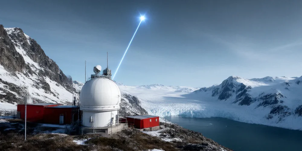
Lidar Stations from Thule to McMurdo: A Global Network for Atmospheric Science
Imagine a network of laser eyes scanning the sky from the frozen Arctic to the windswept Antarctic, all working together to unlock the secrets of our atmosphere. That is exactly what the NDACC lidar network does, day and night, year after year. From Thule Air Base in Greenland to McMurdo Station in Antarctica, these instruments quietly measure the chemistry and structure of the stratosphere, giving scientists the long-term data they need to understand ozone monitoring, climate change, and atmospheric composition. In this post, we take you on a tour of that network, explain how lidar actually works, and look at the UK’s role through facilities like Chilbolton Observatory.
The Backbone of Atmospheric Monitoring: NDACC Lidar Stations
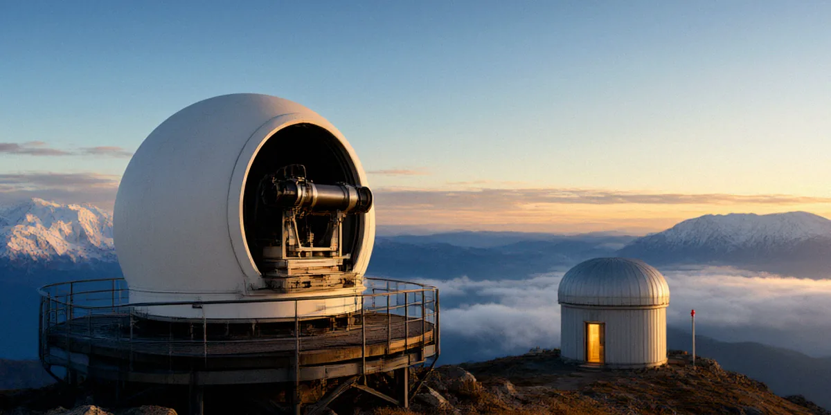
Before we travel to the poles, it is worth understanding what holds this global network together and why it matters so much to atmospheric science.
What is NDACC and why does it matter?
NDACC stands for the Network for the Detection of Atmospheric Composition Change. It is an international research framework that coordinates ground-based measurements of the atmosphere, and lidar is one of its most important tools. The network’s stations are distributed across both hemispheres, from the high Arctic to the Antarctic plateau, and they all follow common measurement protocols so that their data can be compared directly.
Why does that matter? Because the atmosphere does not behave the same way everywhere. Ozone depletion over Antarctica follows a different pattern from ozone behaviour over Europe, and stratospheric temperatures in the Arctic can vary dramatically from year to year. A single station can tell us what is happening locally, but only a coordinated global network can reveal trends that affect the whole planet.
How lidar stations contribute to atmospheric science
Lidar, which stands for light detection and ranging, allows stations to measure the vertical structure of the atmosphere remotely. Instead of sampling air at ground level, a lidar sends pulses of laser light upwards and analyses what comes back. This gives researchers profiles of ozone, aerosols, and temperature stretching from the lower atmosphere well into the stratosphere. The list below summarises the core contributions of NDACC lidar stations:
- Long-term ozone monitoring in the stratosphere, helping track the recovery of the ozone layer.
- Vertical profiles of aerosols and volcanic particles after major eruptions.
- Temperature measurements that feed into climate models and satellite validation.
- Reference data used to calibrate and verify satellite instruments.
- A consistent, multi-decade record that reveals slow atmospheric trends.
From Thule to McMurdo: A Journey Through Extreme Latitudes
Now let us travel to the ends of the Earth, where some of the network’s most valuable measurements are made under some of the harshest conditions imaginable.
Thule Air Base: Arctic sentinel
Thule Air Base in Greenland is one of the northernmost permanently inhabited settlements on the planet, and it hosts a lidar station that acts as an Arctic sentinel. From this remote outpost, researchers monitor the polar stratosphere during the dark winter months, when temperatures can plummet low enough to form polar stratospheric clouds. Those clouds play a central role in Arctic ozone loss, so data from Thule helps scientists understand why ozone depletion over the Arctic is more variable than over the Antarctic.
McMurdo Station: Antarctic watchdog
At the other end of the globe, McMurdo Station in Antarctica serves as an Antarctic watchdog. McMurdo is the largest research base on the continent and a logistical hub for polar science. Its lidar measurements capture the famous Antarctic ozone hole as it forms each spring, providing a continuous record of how the hole changes in size and depth from year to year. Without stations like McMurdo, our understanding of ozone recovery would be far less complete.
Other key stations bridging the gap
Between these two extremes lies a chain of stations that fills in the mid-latitudes and tropics. Sites across Europe, North America, Asia, and the southern oceans ensure that the network captures atmospheric behaviour across a wide range of latitudes. Each station adds a piece to the puzzle, and together they transform isolated measurements into a genuinely global picture of atmospheric composition change.
How Lidar Works: Shedding Light on the Stratosphere
The technology behind these measurements is elegant, and a basic understanding of it makes the science far more tangible.
The physics behind lidar
A lidar system fires short pulses of laser light into the sky. As those pulses travel upwards, they interact with molecules, aerosols, and particles in the atmosphere. A small fraction of the light scatters back towards the ground, where a telescope collects it and a detector records the signal. Because light travels at a known speed, the time it takes for the signal to return tells the instrument how high the scattering occurred. By analysing the strength and characteristics of the returning light, researchers can work out what the atmosphere is doing at each altitude.
What lidar reveals about ozone and climate
Different lidar techniques target different things. Differential absorption lidar, for example, uses two wavelengths — one that ozone absorbs strongly and one that it does not — to calculate ozone concentration at each height. Other systems measure aerosol backscatter or use Rayleigh scattering to derive temperature. The result is a detailed vertical profile of the stratosphere, which is exactly what is needed for ozone monitoring and for tracking how the atmosphere responds to climate change.
The UK’s Role in Global Lidar Research
The United Kingdom is an active participant in NDACC, and British facilities and universities contribute both measurements and expertise to the network.
Chilbolton Observatory: A UK hub
Chilbolton Observatory in Hampshire is one of the UK’s most important atmospheric research facilities. Its lidar systems contribute to ozone monitoring and aerosol measurements, and the site acts as a hub for UK-based atmospheric science. Data from Chilbolton feeds into international comparisons and helps validate satellite observations over northern Europe.
Collaborations with UK universities
Alongside Chilbolton, UK universities and research councils support lidar research through instrument development, data analysis, and fieldwork. These collaborations connect British scientists to the wider NDACC community, ensuring that UK expertise plays a part in shaping global measurement standards and in training the next generation of atmospheric researchers.
Challenges and Triumphs of Polar Lidar Operations
Running a lidar station at the extremes of the planet is not for the faint-hearted. The scientific rewards are significant, but so are the obstacles.
Operating in extreme cold
At Thule Air Base and McMurdo Station, temperatures can drop far below freezing, and winter darkness limits when measurements are possible. Equipment must survive conditions that would quickly disable ordinary electronics, and engineers often have to troubleshoot instruments in remote locations with limited support. Every successful measurement campaign in these environments represents a genuine triumph of planning and resilience.
Data quality and continuity
Long-term records are only useful if they are consistent. That means stations must maintain careful calibration, follow shared protocols, and keep instruments running through staff changes and harsh weather. Continuity is the quiet achievement of the NDACC lidar network: decade after decade of comparable data, gathered by many hands in many places.
The Future of Lidar Networks: Expanding Our Vision
Lidar technology continues to evolve, and so does the network that depends on it.
Next-generation lidar systems
New generations of lidar instruments offer improved sensitivity, wider altitude coverage, and greater automation. These advances make it easier to operate stations remotely and to capture subtle changes in the stratosphere that older systems might miss.
Emerging stations and global coverage
There is also a push to expand coverage into regions that are currently under-sampled, particularly in the tropics and the southern hemisphere. Filling those gaps will strengthen the network’s ability to detect global trends and to support ozone recovery monitoring as the planet continues to change.
From Thule Air Base in Greenland to McMurdo Station in Antarctica, and through key European sites like Chilbolton Observatory, the NDACC lidar network provides an irreplaceable record of our atmosphere. It supports ozone monitoring in the stratosphere, validates satellites, and underpins our understanding of climate change. Continued international collaboration, sustained funding, and shared expertise will be essential if we are to keep these laser eyes watching the sky for decades to come.
FAQ
What does NDACC stand for?
NDACC stands for the Network for the Detection of Atmospheric Composition Change. It is an international network of ground-based stations that measure the chemistry and structure of the atmosphere, with lidar playing a central role in those measurements.
Why are Thule Air Base and McMurdo Station so important?
Thule Air Base in Greenland and McMurdo Station in Antarctica sit at opposite ends of the Earth, in the polar regions where ozone depletion is most pronounced. Their lidar measurements capture the formation of polar stratospheric clouds and the Antarctic ozone hole, giving scientists data that simply cannot be obtained elsewhere.
How does lidar measure ozone in the stratosphere?
Lidar sends laser pulses upwards and analyses the light that scatters back. Using techniques such as differential absorption lidar, which compares two wavelengths, researchers can calculate ozone concentration at different altitudes and build a vertical profile of the stratosphere.
What is the UK’s contribution to NDACC?
The UK contributes through facilities such as Chilbolton Observatory, which supports ozone monitoring and aerosol measurements, as well as through collaborations with UK universities and research councils that develop instruments, analyse data, and train researchers.
Why is long-term data continuity so important?
Atmospheric trends unfold over decades, so a consistent record is essential to distinguish genuine long-term change from short-term variability. Maintaining calibration and measurement protocols across the NDACC lidar network allows scientists to track ozone recovery and climate-related changes with confidence.